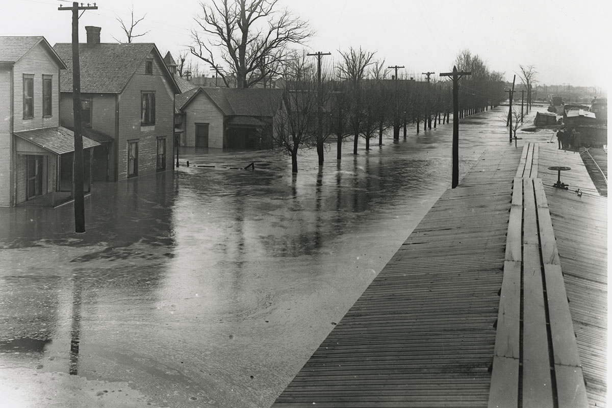
PHOTO CREDIT: Great Flood of 1913, Madison Street. Image courtesy of Ball State University’s Bracken Archive and Special Collections.
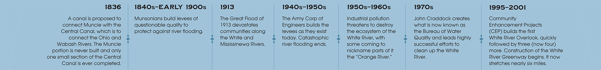
People have lived along the West Fork of the White River for thousands of years. The Myaamia (Miami) called the river Waapikaminki, the Lenape (Delaware) named it Oppecomecah, and French settlers named the river, la rivière Blanche. For years, Muncie was prone to floods, with major deluges recorded in the 19th and 20th centuries. A concerted effort was made in the early 20th century to erect earthen dams, but these efforts often failed in heavy rains. The 1913 flood left much of the city underwater, destroyed several bridges, and led to increased demands for permanent levees.
In the mid 20th century, the levees we see today were constructed by the Army Corps of Engineers and major flooding ceased altogether. After Muncie industrialized, the White River became heavily polluted with industrial waste, destroying the river’s ecosystem. Beginning in the 1970s and continuing to this day, local environmentalists like John Craddock made significant efforts to reduce point source discharge, agricultural runoff, and to separate the storm and waste-water sewers. Today, the river is a vibrant, healthy ecosystem for fish and wildlife, and the White River Greenway allows people to enjoy this great natural resource.
The White River through Muncie.
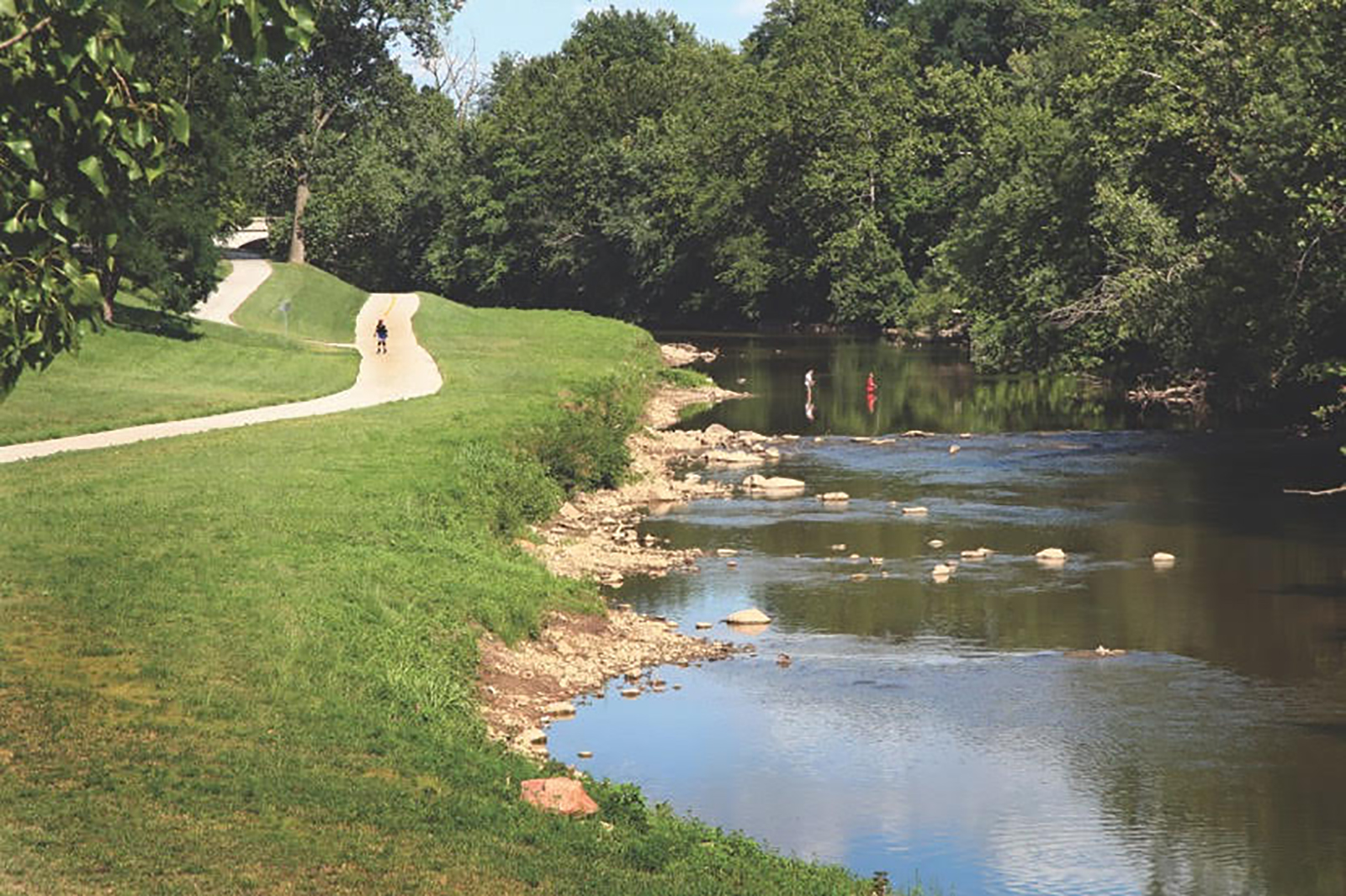
White River and White River Greenway, 2017. Photo courtesy Community Enhancement Projects.