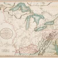
A new map of part of the United States of North America, exhibiting the Western Territory, Kentucky, Pennsylvania, Maryland, Virginia &c. also the lakes Superior, Michigan, Huron, Ontario & Erie; with Upper and Lower Canada &c. from the latest authorities (1805)
Dublin Core
Title
A new map of part of the United States of North America, exhibiting the Western Territory, Kentucky, Pennsylvania, Maryland, Virginia &c. also the lakes Superior, Michigan, Huron, Ontario & Erie; with Upper and Lower Canada &c. from the latest authorities (1805)
Files
Citation
“A new map of part of the United States of North America, exhibiting the Western Territory, Kentucky, Pennsylvania, Maryland, Virginia &c. also the lakes Superior, Michigan, Huron, Ontario & Erie; with Upper and Lower Canada &c. from the latest authorities (1805),” Notable Women of Muncie and Delaware County, accessed July 3, 2024, https://digitalresearch.bsu.edu/notablewomen/items/show/257.

