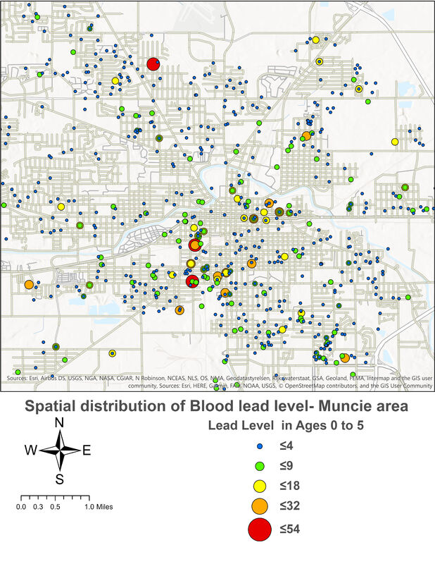
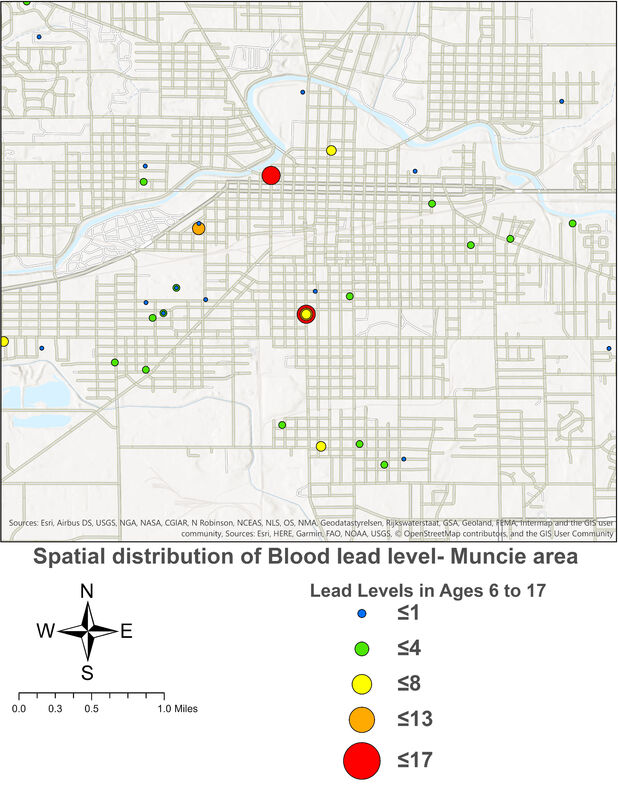
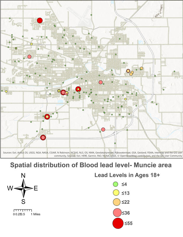
Spatial distribution of Blood lead level
The Regenstrief Institute provided the blood lead levels for the research purposes. Patient protection measures were applied according to BSU's IRB Protocol #1181099-2. Spatial distribution of blood lead level for Muncie's residents allows us to visually identify the places most affected, enabling us to determine the appropriate places for soil sampling to determine the lead in the city soil


