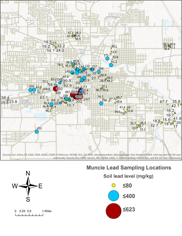
Spatial distribution of soil lead level
Soil sample points were selected based on the blood lead level map and collected by a modified Housing and Urban Development (HUD) method (HUD, 2012). The sites were chosen based on their proximity to individuals having a BLL test result of five micrograms per deciliter or above. Soil samples at depths of 10 cm were collected between 2018 and 2020 in the field through random sampling from the study area. Soil samples were air-dried and passed through a 10 mm sieve for laboratory analysis. Soil texture and soil pH were determined using the standard analytical methods.

